Next location: westbound eastbound
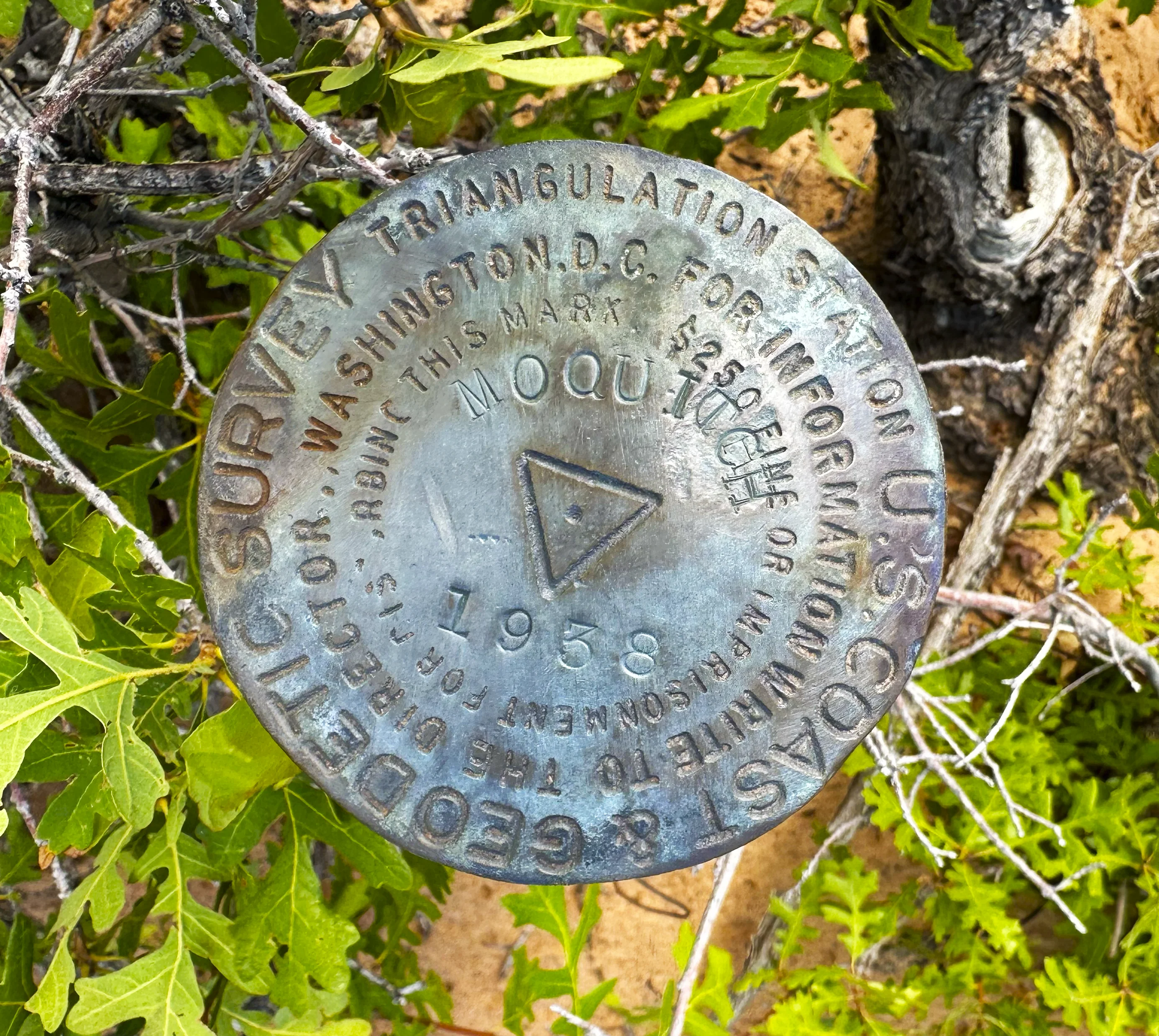
Moquitch Triangulation Station on Ed Lamb Point
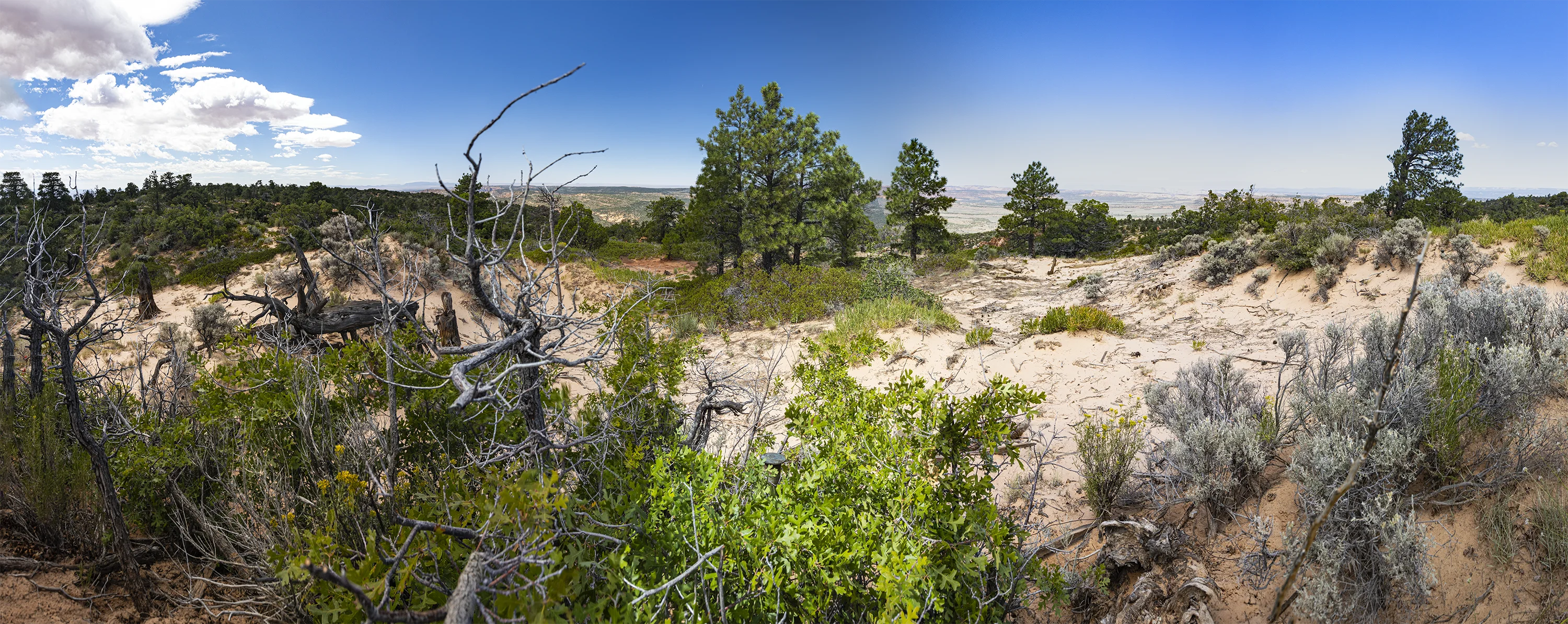
Between Colorado City, Arizona and Kanab, Utah sits Ed Lamb Point, a mesa of Navajo sandstone rising above Vermillion Cliffs and the Kaibab Indian Reservation. Accessible only by rugged Jeep trails, it rises to 7,041 feet at the site of the triangulation station named Moquitch, a few feet south of the actual state line.
Just out of curiosity, you might ask, who was Ed Lamb? Here’s a possible answer that fails to answer who made the designation, even if this is the right guy:
Ed Lamb (1861-1940) moved as a teenager to Orderville, Utah, about 25 miles north of here, in 1877. A lifelong stockman in southern Utah and the Arizona Strip, he was a member of the Orderville United Order, founded in 1875. With the support of Brigham Young, Orderville was established as a utopian community in which prospective members were queried about their moral character (“Do you train your family in the fear of the Lord?”) and willingness to work hard. The community disallowed real and personal private property and fostered the development of community-owned businesses that focused on livestock, blacksmithing, dairy, knitting, lumber, tanning, millinery, poultry, carpentry, and midwifery, among others. More than 20 miles north of Kanab, the isolated residents quickly became remarkably self-sufficient.1
After the death of Brigham Young, LDS enthusiasm for the experiment faded; apparently many members were polygamous and subjected to raids by US marshals; many Orderville leaders were jailed. The community voted itself out of existence in 1885. Ed Lamb at 18 married 17-year-old RoseAnnah Stolworthy and had 10 children. He became a bishop of the LDS church. The original wooden buildings of the Orderville community have long since disappeared. Ed Lamb Point serves as a reminder of the grit and tenacity of Mormon pioneers.
——————————————————-
Footnote
1 Martha Sonntag Bradley, A History of Kane County, Salt Lake City: the Utah Historical Society, 1999) http://www.riversimulator.org/Resources/History/UtahCounties/HistoryOfKaneCounty1996Bradley.pdf