Next Location: westbound eastbound
I respectfully acknowledge that the following story involves the lands of the Quapaw Nation.
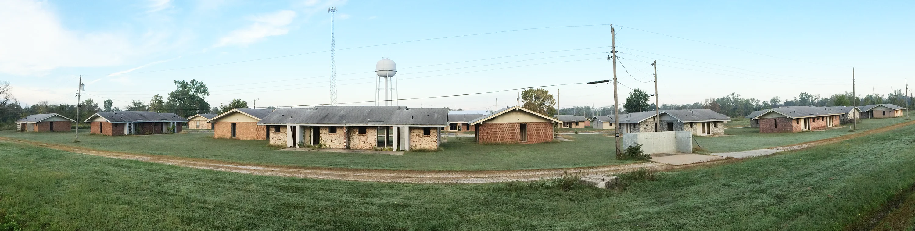
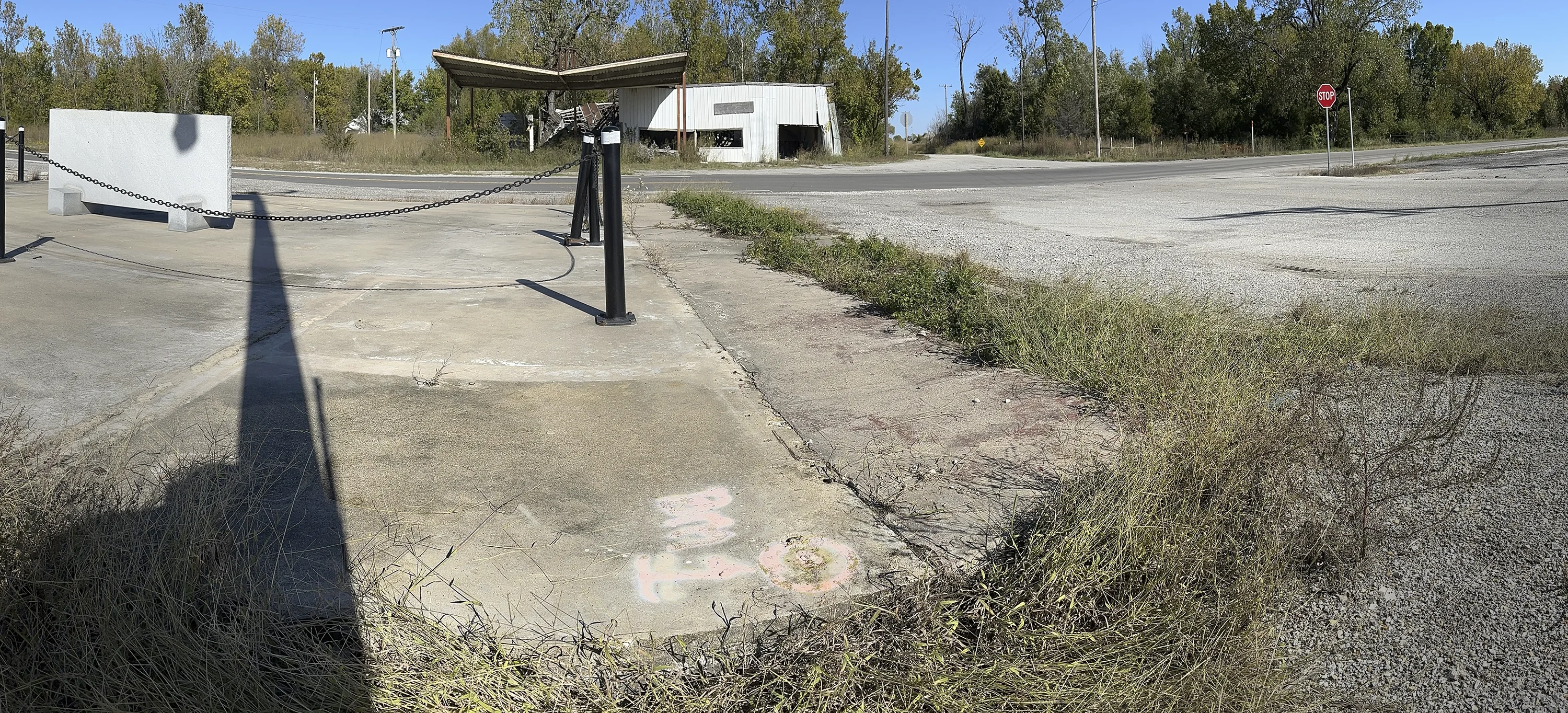
Sometimes the plain sense of things fails to catch the notice of the passer-by. The casual through-traveler— either crossing from Kansas into Oklahoma on US 69 (north-south) or out riding the border fences on State Line Road (east-west)— will hardly realize that Picher, OK and Treece, KS ever existed– they’ve been abandoned and bulldozed, their populations reduced to zero. They still have zip codes– but no post offices.
On May 30, 1857, Hugh Campbell, on the team of astronomers who calculated the longitude and latitude along the line, wrote in his diary that the Quapaws were “almost extinct.” Although Picher and Treece arose and fell in the intervening years, the Quapaws remain, stubbornly fighting to rid their land of the toxic detritus left by the lead miners.
From an altitude of 250 feet, here’s what the two towns look like:
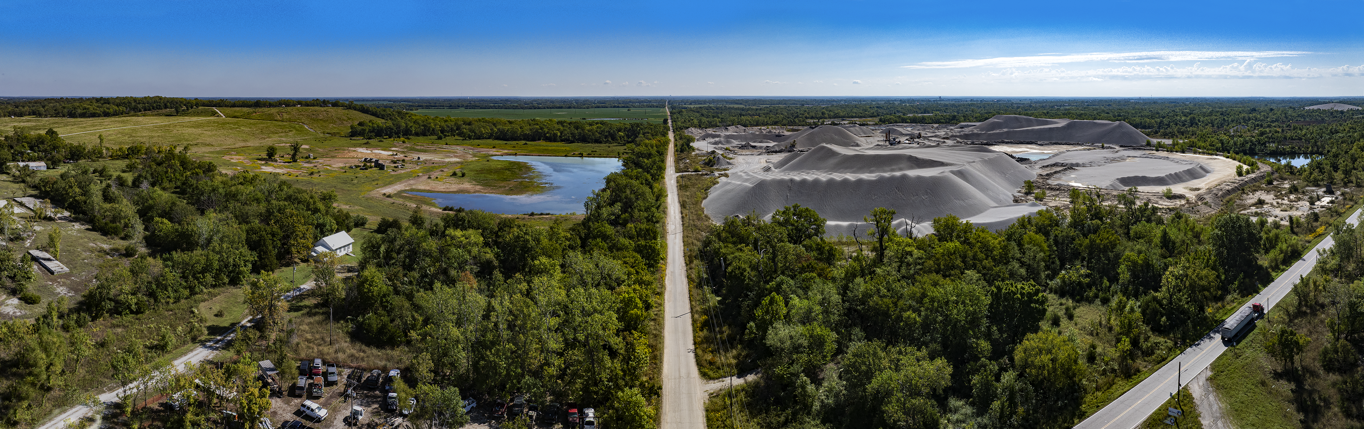
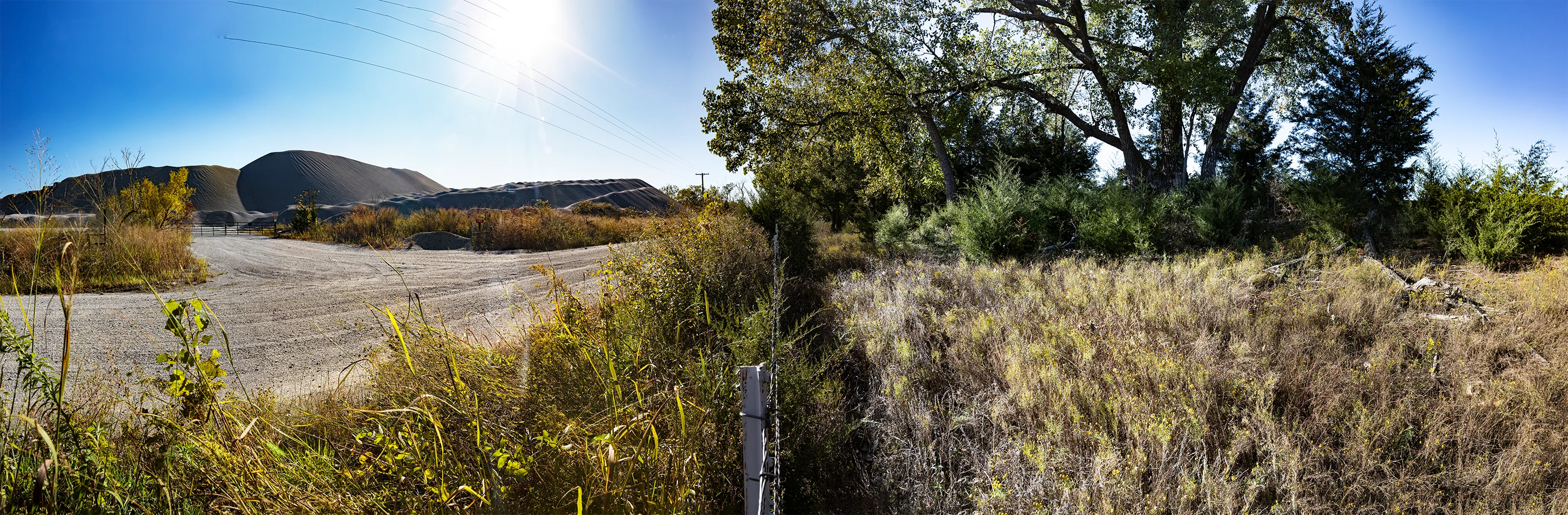
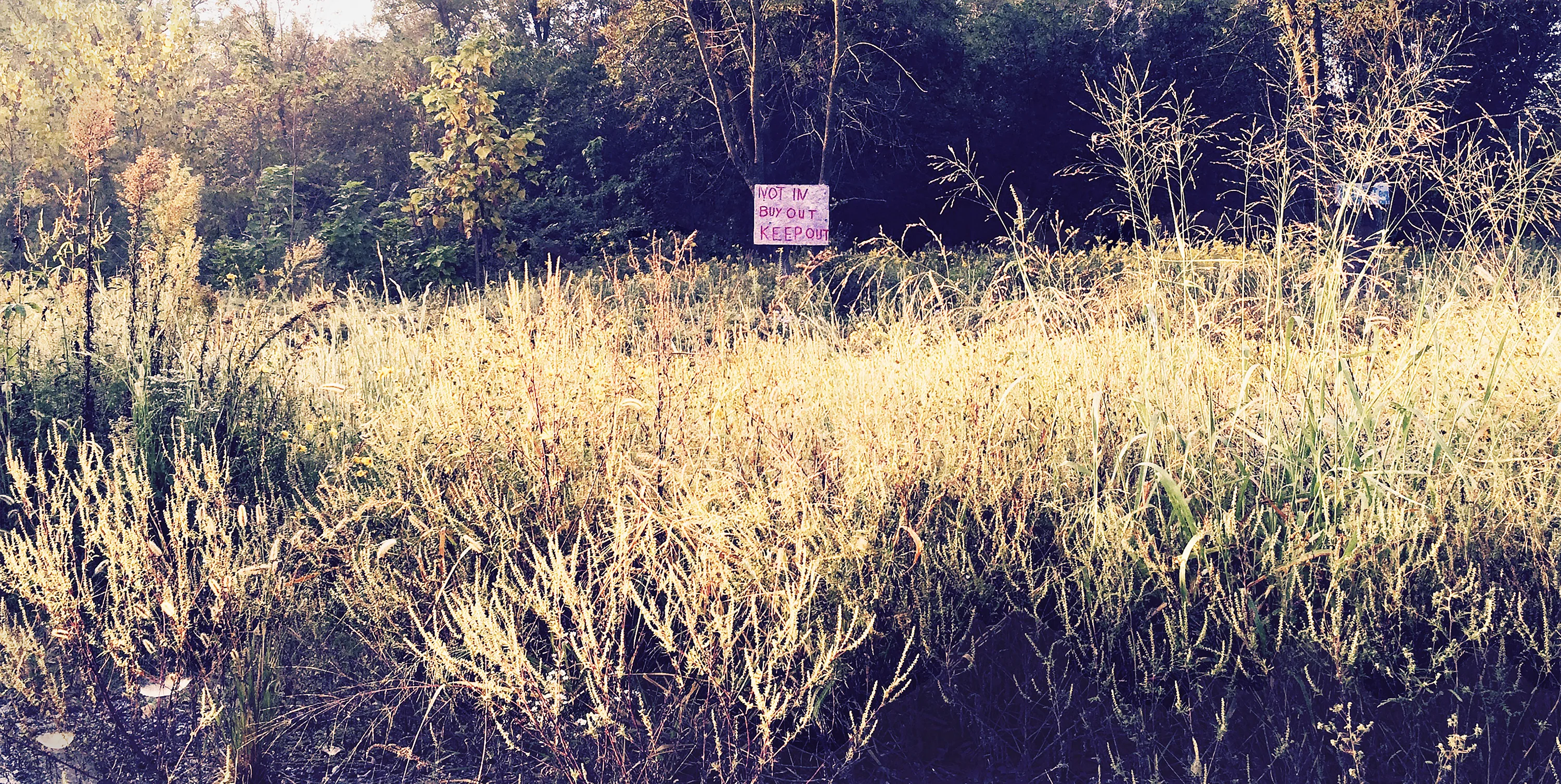
The giant debris piles, called chat, were a by-product of lead and zinc mining that began in 1913. More than half the lead and zinc used during the First World War was mined here; although mining peaked in the mid twenties, ore extraction continued until 1947. Mining contaminated the water table and left gray toxic mountains of siliceous rock, limestone, and dolomite on the surface and undermined the towns themselves; residents moved out not only because of health issues but because their houses were in danger of sudden collapse into mine tunnels. The municipality of Picher was dissolved in 2009; Treece followed in 2012. Both towns were abandoned. The EPA is still (allegedly) working on cleanup after buying out the residents of the two towns.
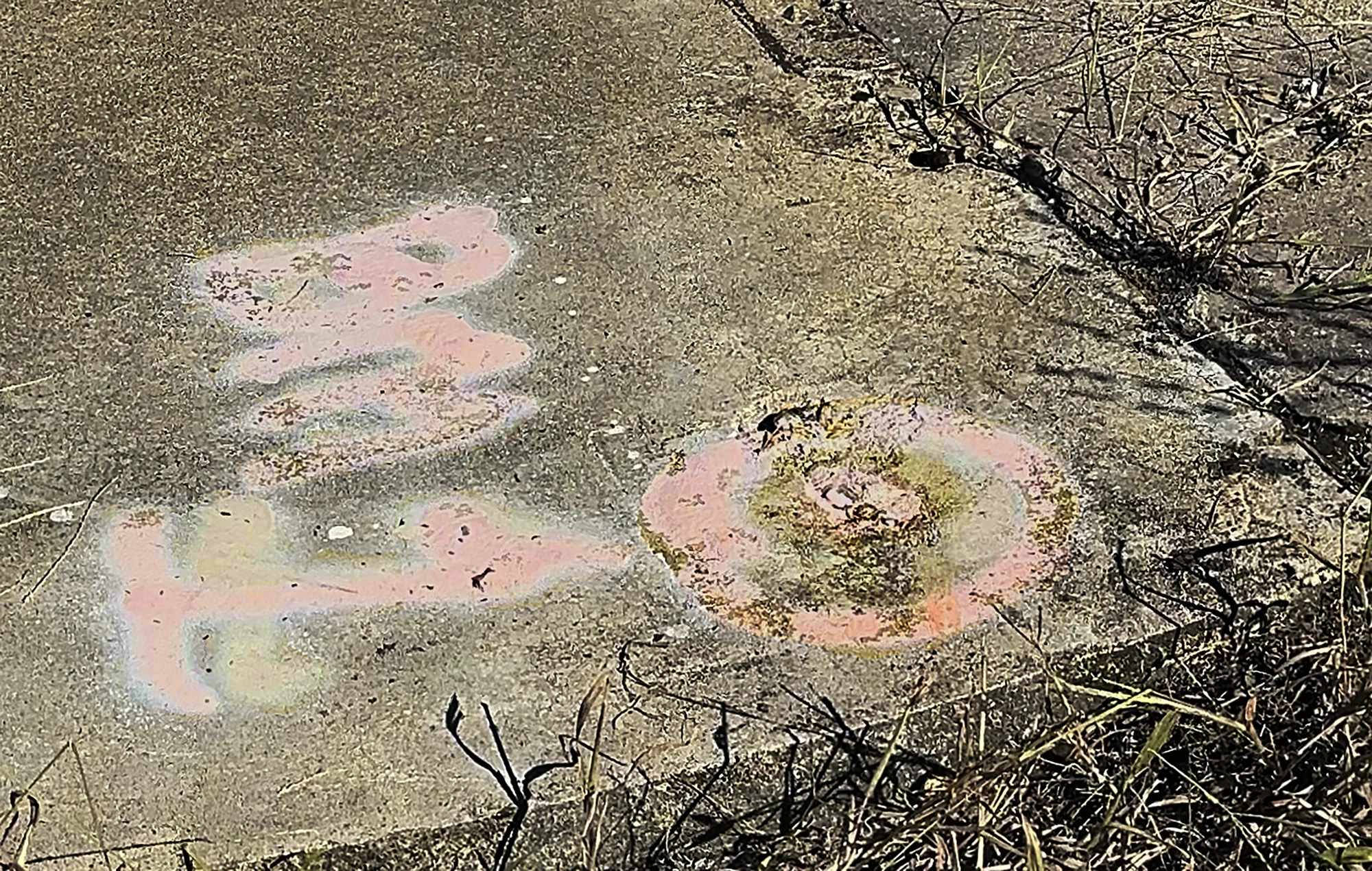
The 37th parallel– or at least the state border– runs along the north side of State Line Road through a benchmark identified by graffiti-like faded pink spray paint, which looks like it was tagged by a gang who happened to be surveyors. Somehow the lack of a classic surveyor’s monument— a steel pipe and a brass cap— seems fitting for this ghosted pair of communities.
On the bright side: the landmark McGirt v. Oklahoma decision by the Supreme Court in 2020 paved the way for the Quapaws to affirm their status as a reservation, allowing them to assert control over the Tar Creek superfund cleanup that has been languishing since 1983. Oklahoma Governor Kevin Stitt lamented, ”The Supreme Court ruling continues to tear Oklahoma apart…. Oklahoma has lost much of … [the] ability [to enforce the rule of law] in the eastern half of our state, and as of today, that now includes another portion of Ottawa County. McGirt not only creates a public safety nightmare, but threatens the sovereignty of our state to its core.”1 The Quapaws and the Five Civilized Tribes might sympathize, sardonically, with the state as it faces the loss of sovereignty– in a been-there, done-that kind of way.
Treece and Picher are emblematic of the most profligate failure of land stewardship. The Tar Creek Superfund site, initiated over 40 years ago, still is incomplete. The “Final Strategic Plan,” issued in 2019, included no projected end date.
Footnote
(1) Nancy Marie Spears, Gaylord News Oct. 22, 2021