Next location: westbound eastbound
A few miles south-southwest of Cedar Vale, KS, and west of the Boots monument on the state border, where Kansas’ 337th Road becomes Oklahoma’s CR 4551 in the valley of Acker Creek, we have a story of settler abandonment.
Charged with surveying the southern border of Kansas in 1857, The Johnston-Weysse expedition included three diarists, all of whom reported on the day the party passed through here on July 1, 1857. Hugh Campbell, the expedition’s Astronomical Computer, reported in his diary that “Graizing in the vicinity is excellent.” Eugene Bandel, a 21-year-old Russian immigrant serving as private in the infantry attachment that accompanied the surveyors, reported in his diary, “We seen a buffalo.” Team leader Colonel Johnston reported that the grass was “knee high & very thick & fresh looking.”1
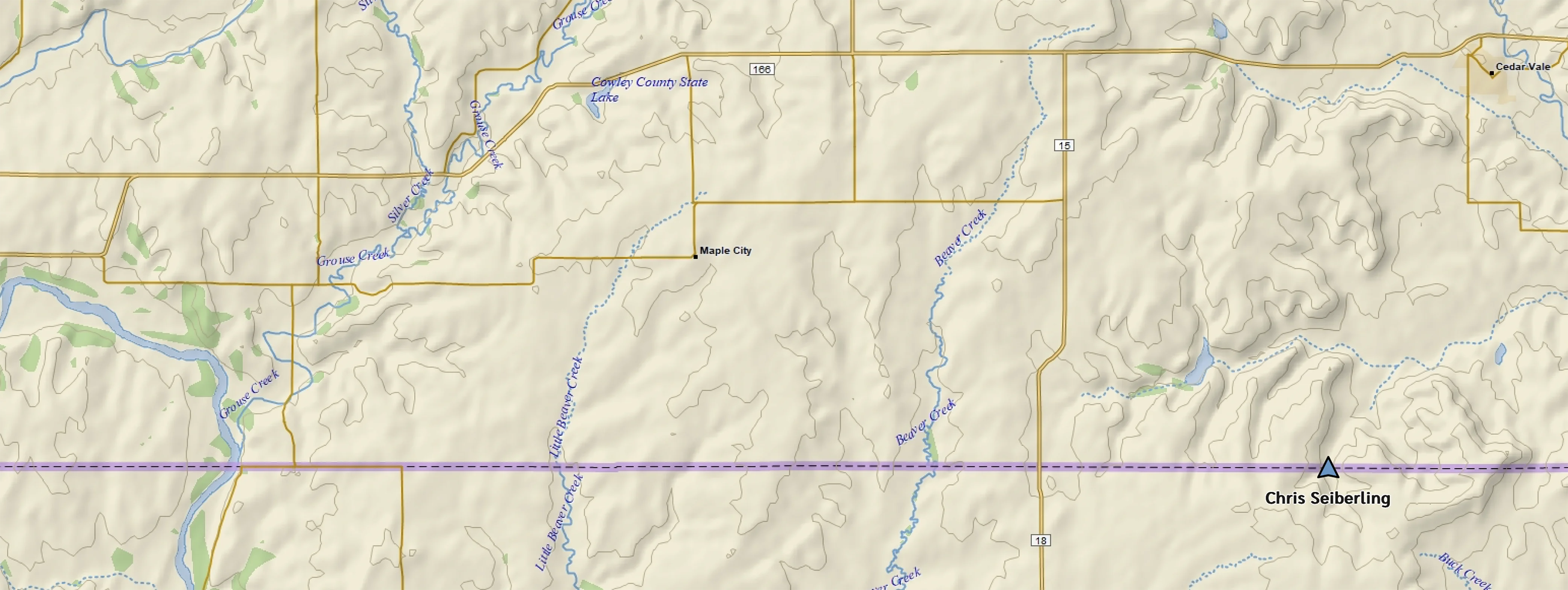
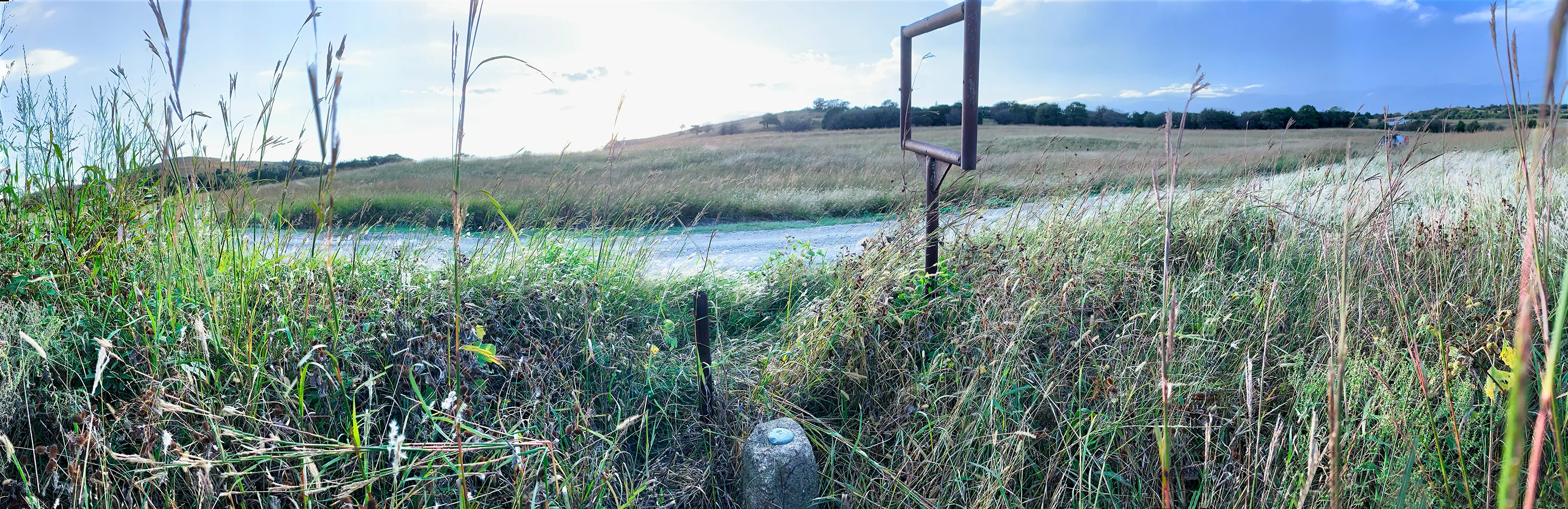
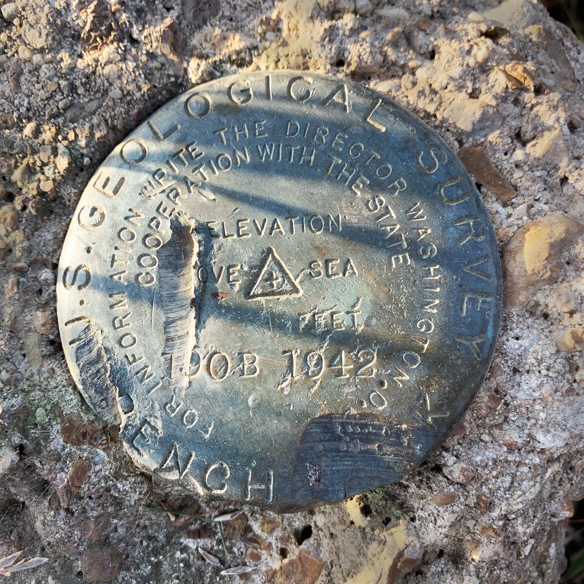
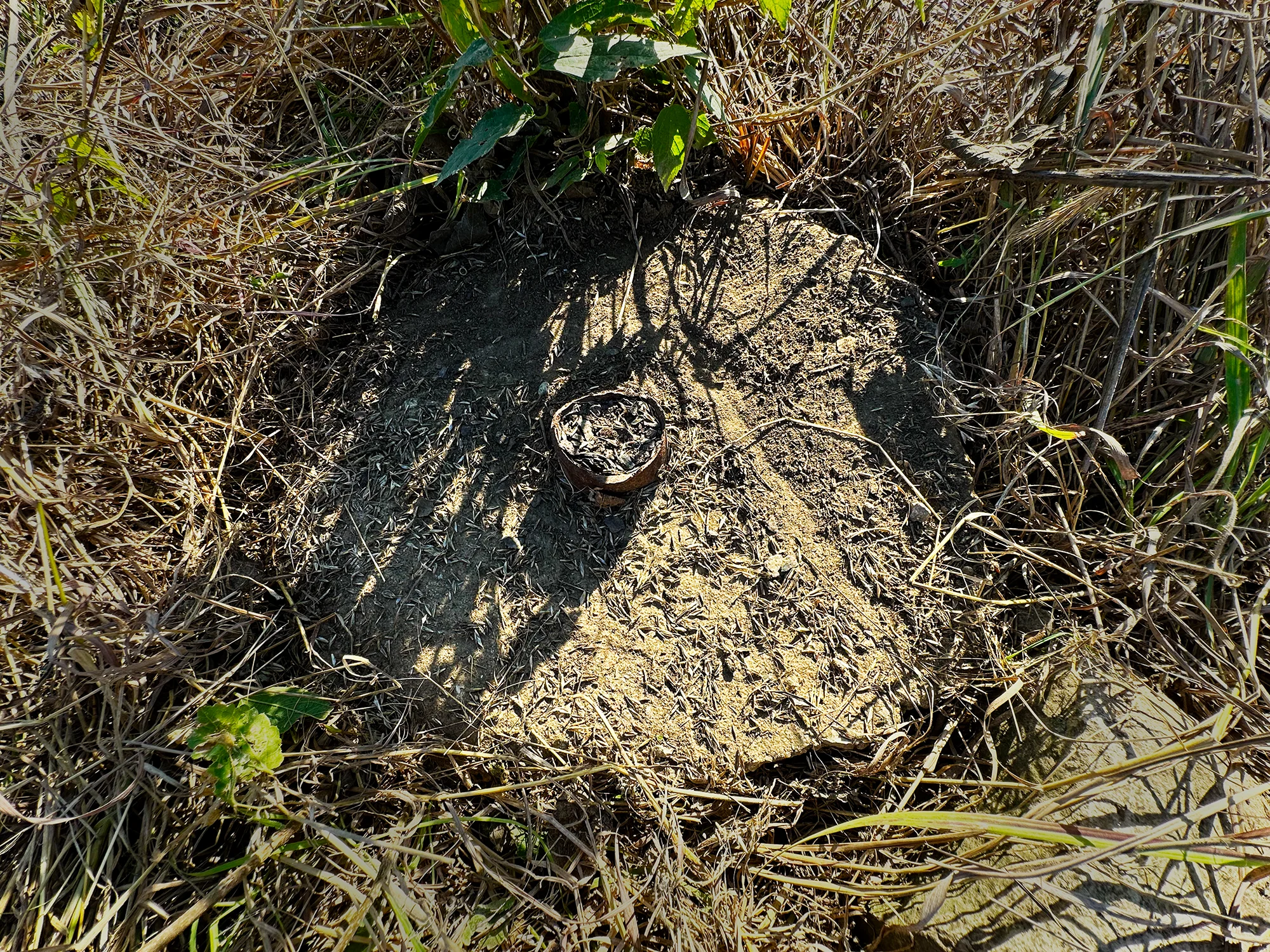
Thirteen years later the nearby town of Cedar Vale, Kansas, was founded, but it failed to attract an influx of settlers, even though it was called, in 1901, “The Gem of the Sunflower State … the most enterprising Little City on Earth.”2 Its population hovers at 480. It has four churches and a meat locker. South of town at the state border on a seldom-traveled gravel road, near the west bank of Acker Creek, the forgotten grassy slopes evince scant evidence of ranching activity. A first visit here on 2 Oct 2019 led us to the benchmark, apparently stabbed with a shovel, and a curious rectangular sign frame in which a “welcome to Kansas” message might have swung. On a subsequent visit on 27 Sept 2023 we found the benchmark missing, along with the empty sign frame. The benchmark is missing from the NGS database and the NGS map. We’re left with a forlorn remnant of a deliberately forgotten marker on the tallgrass prairie, which, however, appears healthy, even in the absence of bison.
Footnotes
(1) Nyle H. Miller, ed., Surveying the Southern Boundary Line of Kansas From the Private Journal of Col. Joseph E. Johnston, Kansas Historical Quarterly, February 1932 (Vol. 1, No. 2), pages 104 to 139. http://www.kshs.org/p/surveying-the-southern-boundary-line-of-kansas/12540
Martha B. Caldwell, ed., The Southern Kansas Boundary Survey From the Journal of Hugh Campbell. Kansas Historical Quarterly, November 1937 (vol. 6, no. 4), pages 339 to 377.
Diary of Eugene Bandel, 5/16/1857 – 11/14/1857 typescript of diary, from California State Library, Sacramento