Next location: westbound eastbound
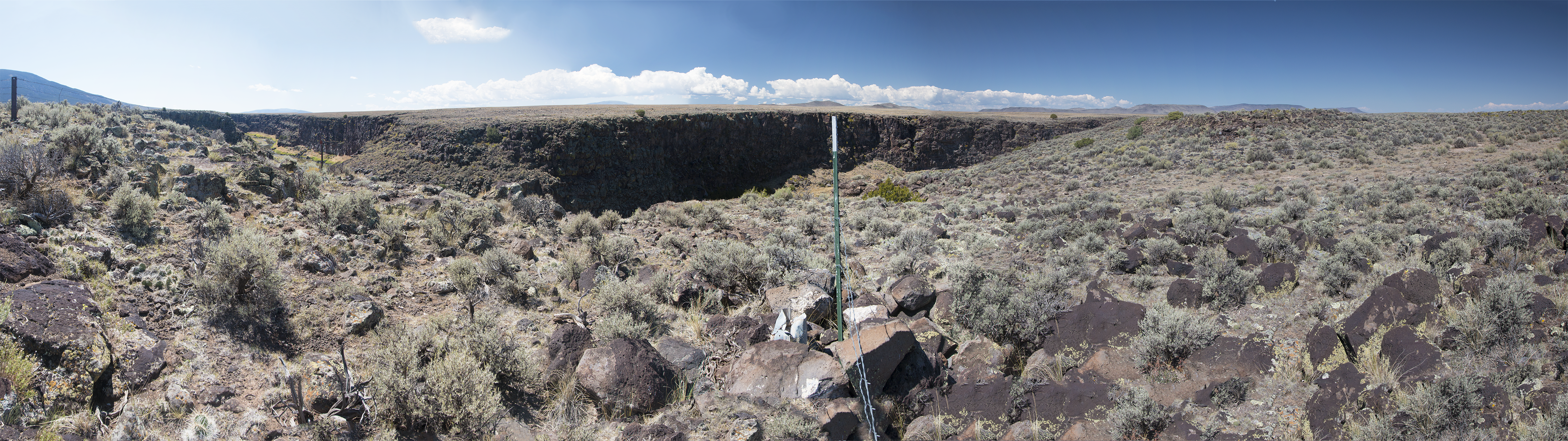
On the east bank of the Rio Grande River, near the beginning of a canyon that runs south of Taos before widening into a broad valley that extends to El Paso. Storied as the water supply for agriculture from Colorado to Tamaulipas, Mexico, it also waters thousands of sandhill cranes at Bosque del Apache National Wildlife refuge and supplies the ever-shallower lake at Elephant Butte dam near Truth or Consequences. Here on the borderland plateau it’s a pleasant, green-lined stream in a shallow but dark canyon below the perennially-parched rangeland.
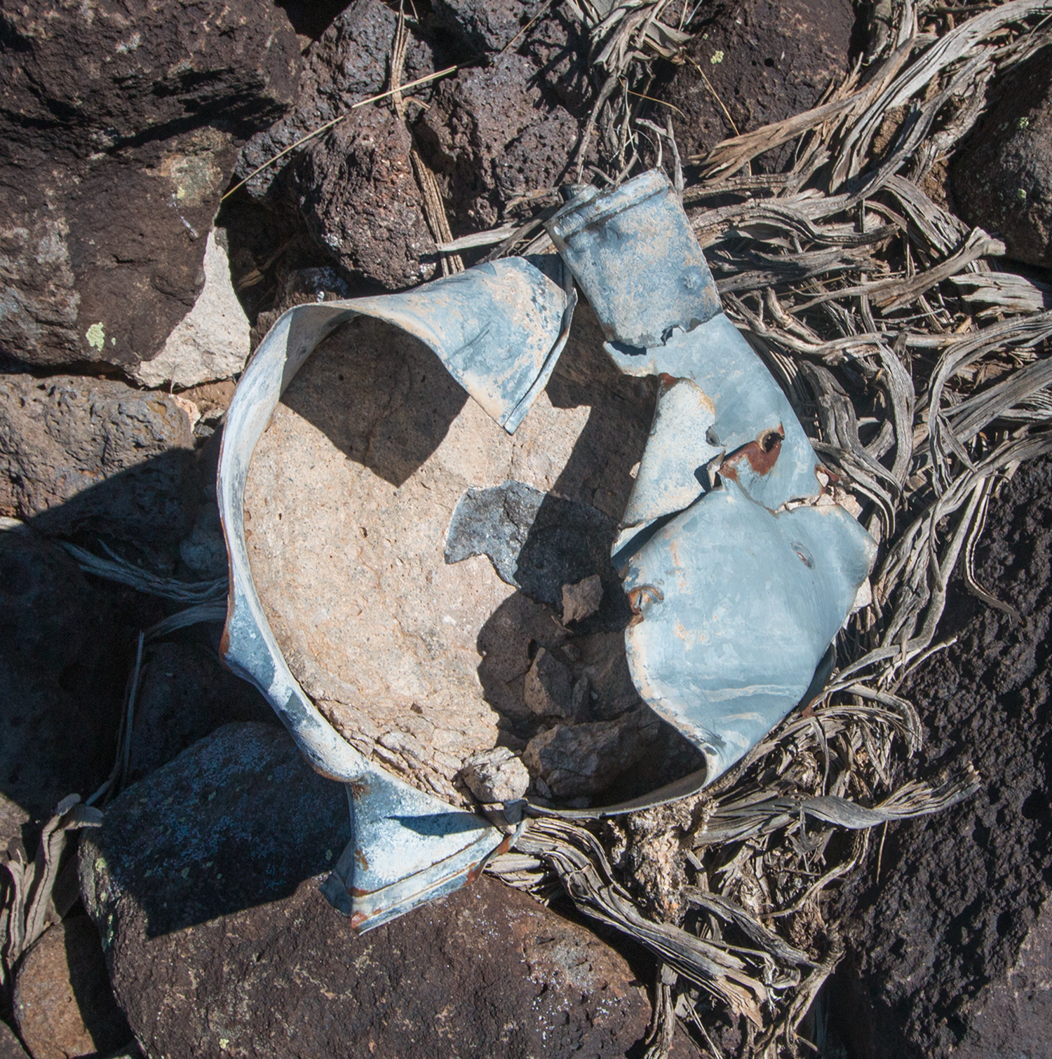
And it’s here we find Astronomical Observatory #5 on the banks of the canyon, at mile 147 + 70.54 chains, vandalized, to boot: it looks like a leg cut from a pair of jeans and filled with concrete:
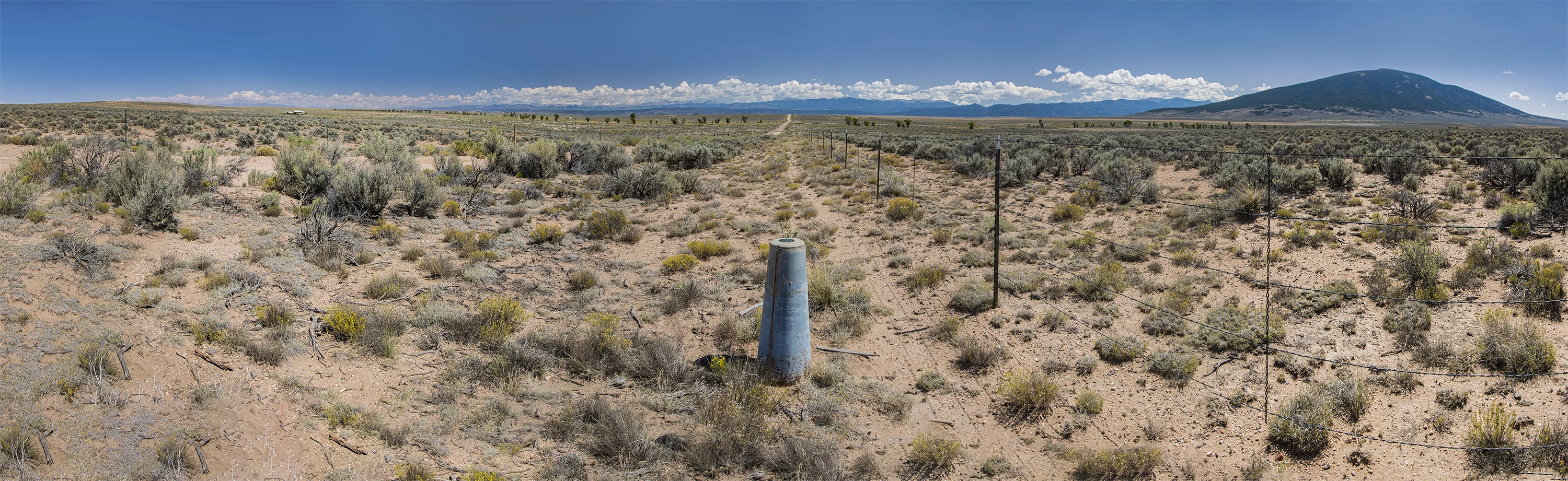
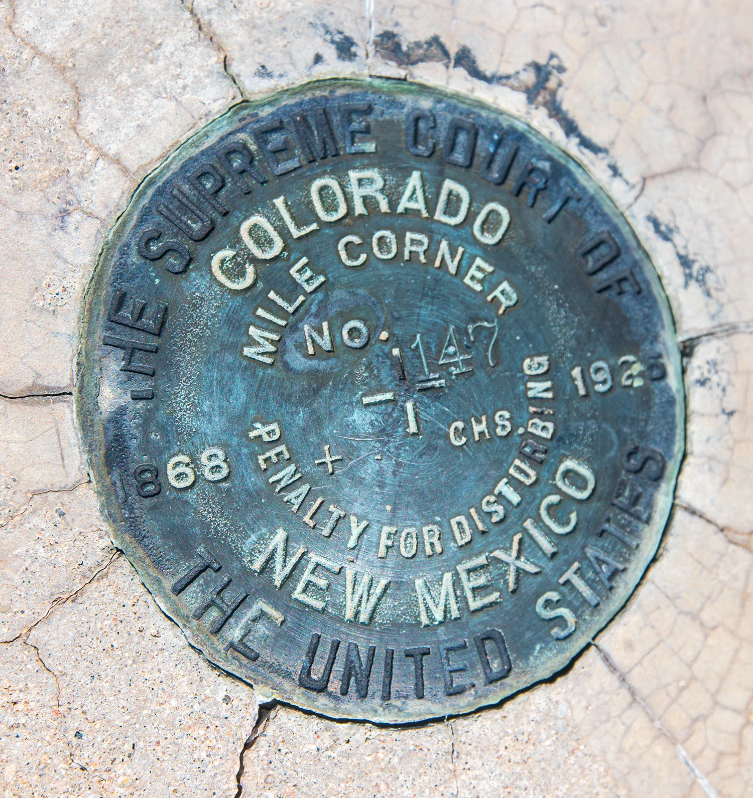
Seven-tenths of a mile east, Mile 147 sits next to the road along the state boundary. On the left, one small house near the edge of the immense quadrangle known to USGS as Sky Valley Ranch, an unfulfilled pipe dream imagined by a desert developer. On the right, Ute Mountain, a 2000 foot symmetrical cone, rises above the Rio Grande del Norte National Monument, an immense swath of cactus and grass that’s difficult to raise cattle on.