Next location westbound eastbound
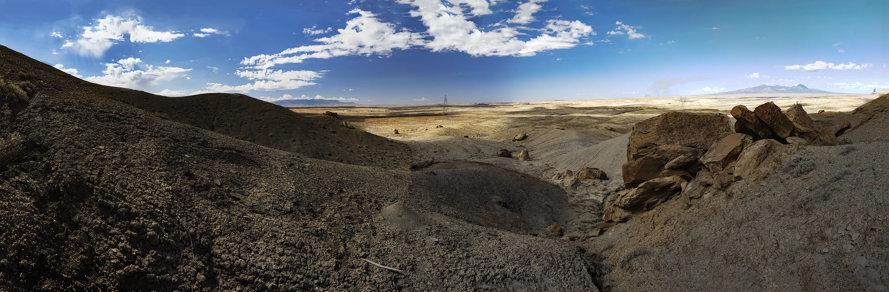
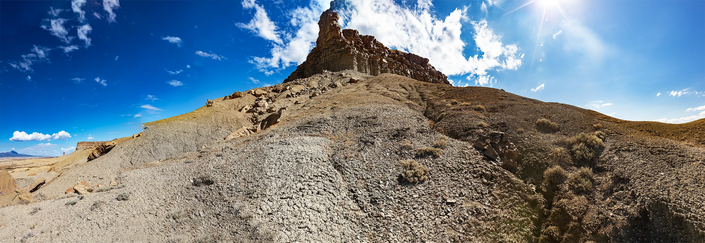
Our backs to a mesa at the site of Ehud Darling’s 10th Astronomical Monument, we align our view toward Four Corners with an electric transmission tower that stands as a gnomon half way to the horizon.
The soil underfoot seems to have risen like choux pastry after the last time it rained here, but it’s as dry as silica gel now: our footfalls crush the surface to dust. If the last rain brought any plants to the surface, they’re withered now. On the map below, Four Corners is on the left edge and we’re on the right….
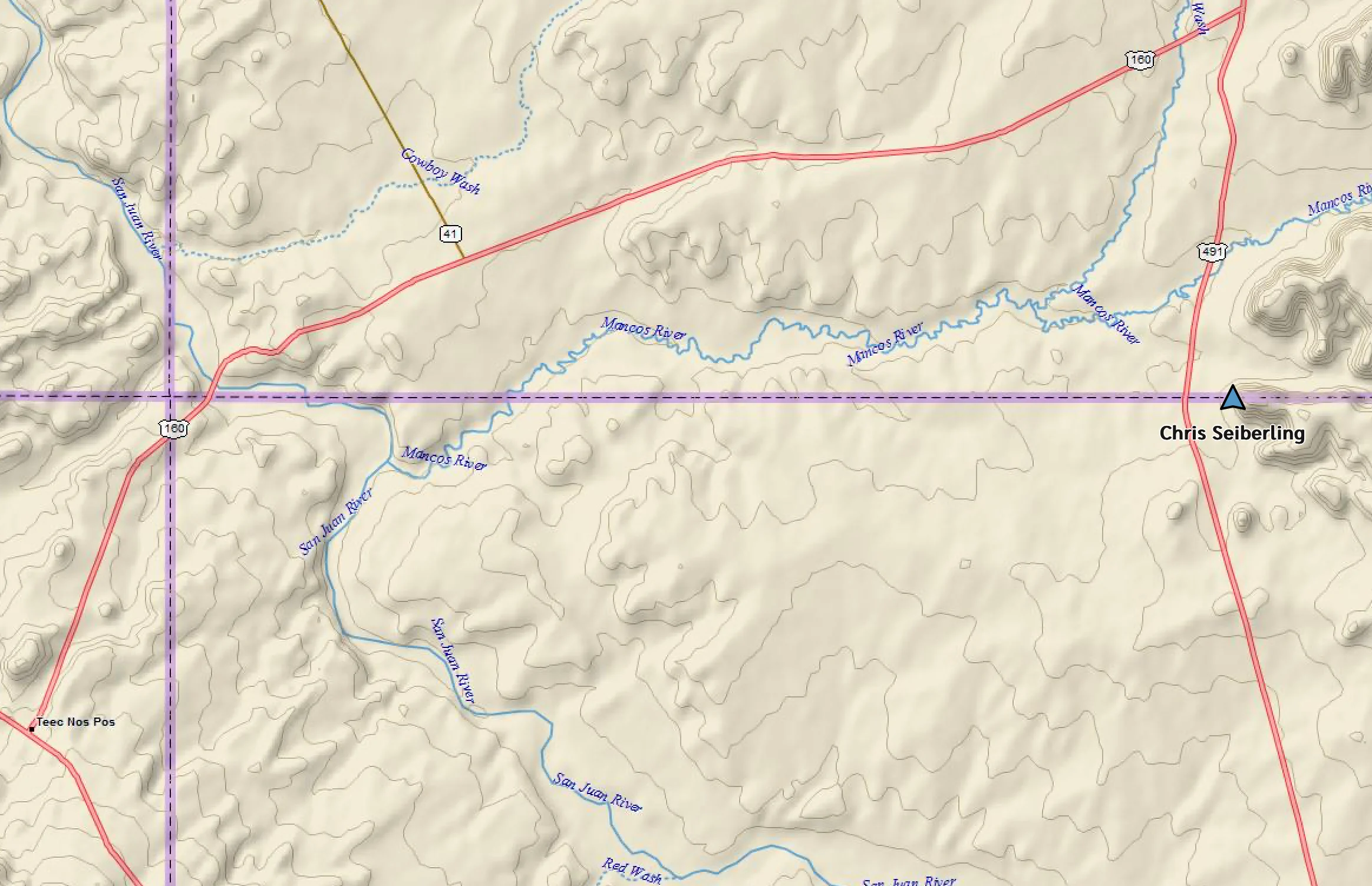
… where we can still hear the semis on U.S. 491 whining into Colorful Colorado and New Mexico True, as the welcome signs allege. Earlier maps, by the way, designated the highway as US 666, and, in a classic example of overthinking in the desert, “the Devil’s Highway” was renumbered in 2003. “The road features a pretty spooky reputation and some of the strange activity witnessed are: a haunted truck, the girl in the white dress, weird lights, hell hounds, disappearing drivers, the Skin Walkers or Satan’s sedan.” (1)
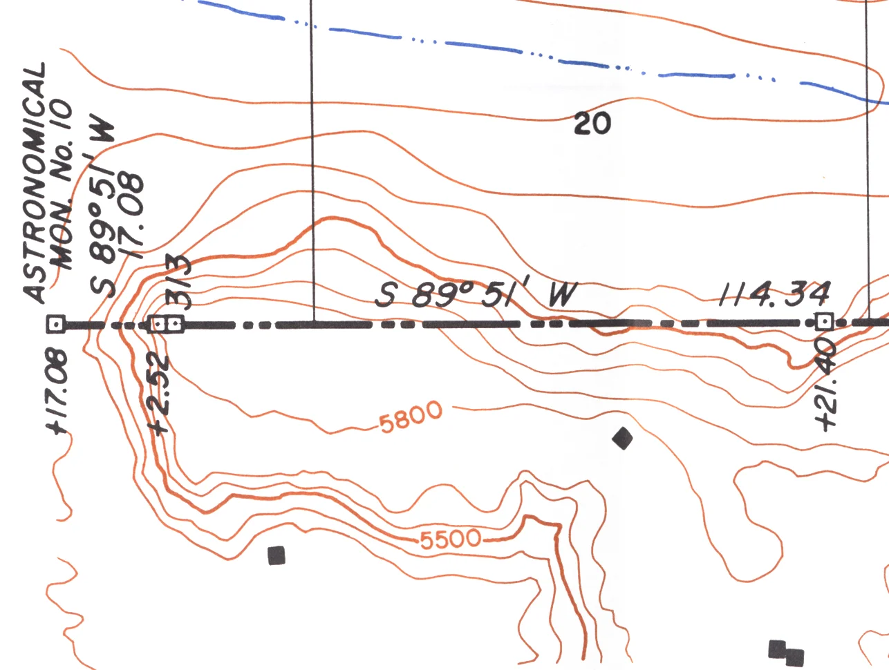
The survey marker– placed by Arthur Kidder in 1925 to re-instantiate Ehud Darling’s Astronomical Monument #10, 313 miles and 19.6 chains from Macomb’s monument on the Oklahoma line– must have been washed out. It’s obviously not hiding in trees or undergrowth in this dessicated landscape. We’re within a few feet of 36 degrees 59′ 56.4468″ N, 108 degrees 44′ 9.1464″W.