Next location: westbound eastbound
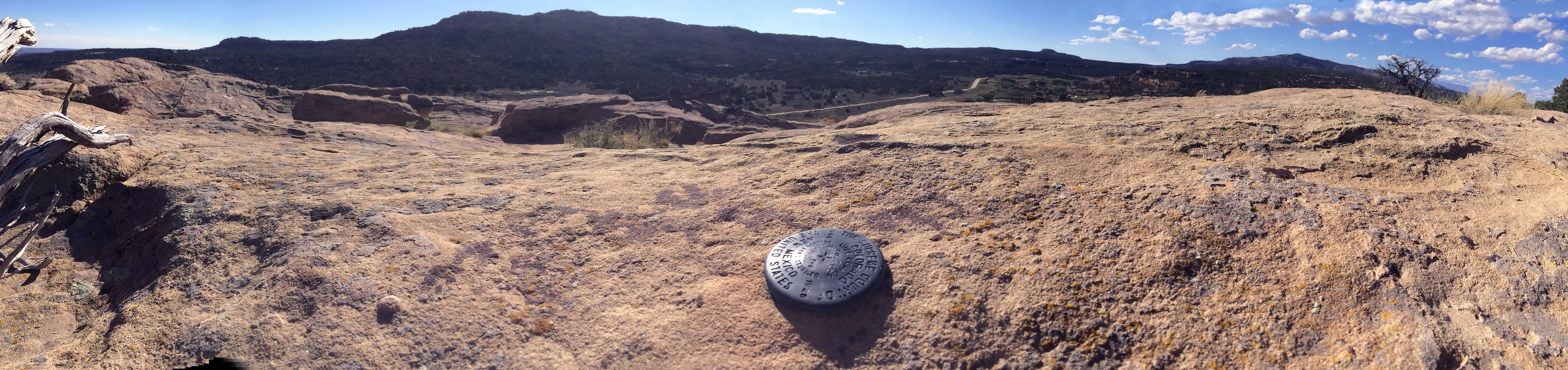
The map showed us that we’d find a monument in the neighborhood of Cox Canyon, north of Aztec Ruins, but it was not precisely clear where we’d find the marker. When the GPS told us we’d crossed into Colorado, we drove up the first driveway and walked toward barking guard dogs who prompted the homeowner to emerge, joint compound trowel in hand, interrupted from a renovation project. We exchanged introductions. Pat Rhodes turned out to be connected to the land through a couple of generations and knew his neighborhood. When asked about the border marker on the map, he said he knew just where it was. He jumped in his pickup; we followed him a half mile south on the dusty canyon road. He stopped, got out of his truck and pointed to the top of the canyon wall where two dead tree branches making an X-shaped cross. “You’ll find it there,” he said, confidently, even though he’d never been up to see it for himself.
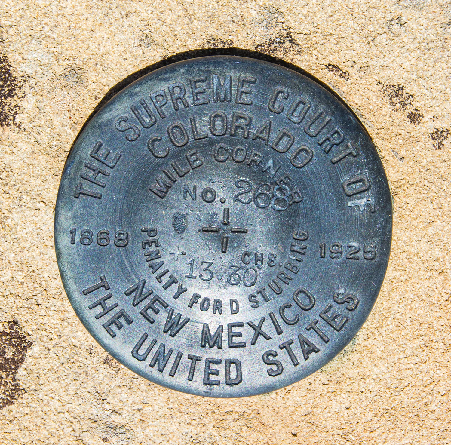
We thanked him and headed another half-mile down the road, turning off next to a roaring gas compressor station. We scanned the cliff for a route to climb up, and, mindful of snakes and loose boulders, we found our way to the top of the mesa. With an eye on the GPS, navigating by the roar of the gas compressor station, we followed contour lines around to the cliff face overlooking Cox Canyon Road. Right at base of the dead branches forming Pat Rhodes’ X-shaped cross, we found the monument for Mile 268 + 13.30 chains.
We revisited in 2018 to take a snap of the monument.